

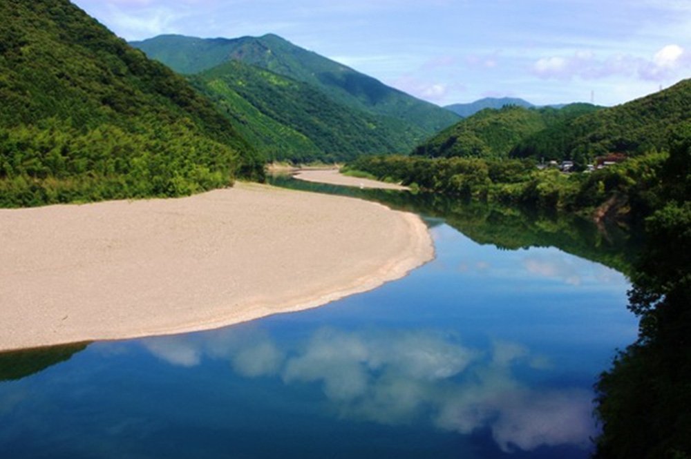
Shimanto Heavens Road
Advanced course
This course can be run together with the scenery of the last clear stream Shimanto River. In the first half, we ran a route facing the sea from Shimanto-shi toward Kuroshio-cho, then went into the mountainous area aiming upstream of Shimanto River,Shimanto River in the second half.
Course contents
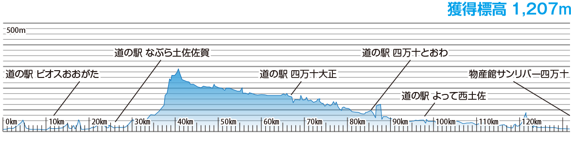
Bussankan Sun River Shimanto > roadside rest area Bios Ogata > roadside rest area Shimanto Taisho era > roadside rest area Shimanto Towa > West Tosa by roadside rest area > Bussankan Sun River Shimanto
Distance of 134 km
Acquired altitude of 1207m
Estimated time: 9 hours
Course height map
Detailed information
- Access to the starting point
- (Busankan Sun River Shimanto) About 60 minutes by car from Shimantocho Chuo IC, short drive from Tosa Kuroshio Railway "Nakamura"